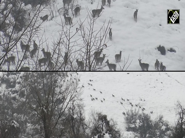
Himachal Pradesh: Rain, Snow continue as Western disturbance remains active; IMD forecasts more snow and rain
Feb 02, 2026
Shimla (Himachal Pradesh) [India], February 2 : Light to moderate rain and snowfall continued across several parts of Himachal Pradesh during the past 24 hours, resulting in a sharp drop in day temperatures and cold wave-like conditions at a few places, the India Meteorological Department (IMD) said Tuesday.
According to the IMD's Meteorological Centre in Shimla, maximum temperatures fell by 2 to 10 degrees Celsius at most stations and remained below normal by 3 to 7 degrees Celsius in many areas. Minimum temperatures showed no significant change at several places, though a decline of 2 to 5 degrees Celsius was recorded at a few stations. The lowest minimum temperature in the state was recorded at Tabo in Lahaul and Spiti at minus 7.9 degrees Celsius, while Paonta Sahib in Sirmaur district logged the highest maximum temperature of 23 degrees Celsius.
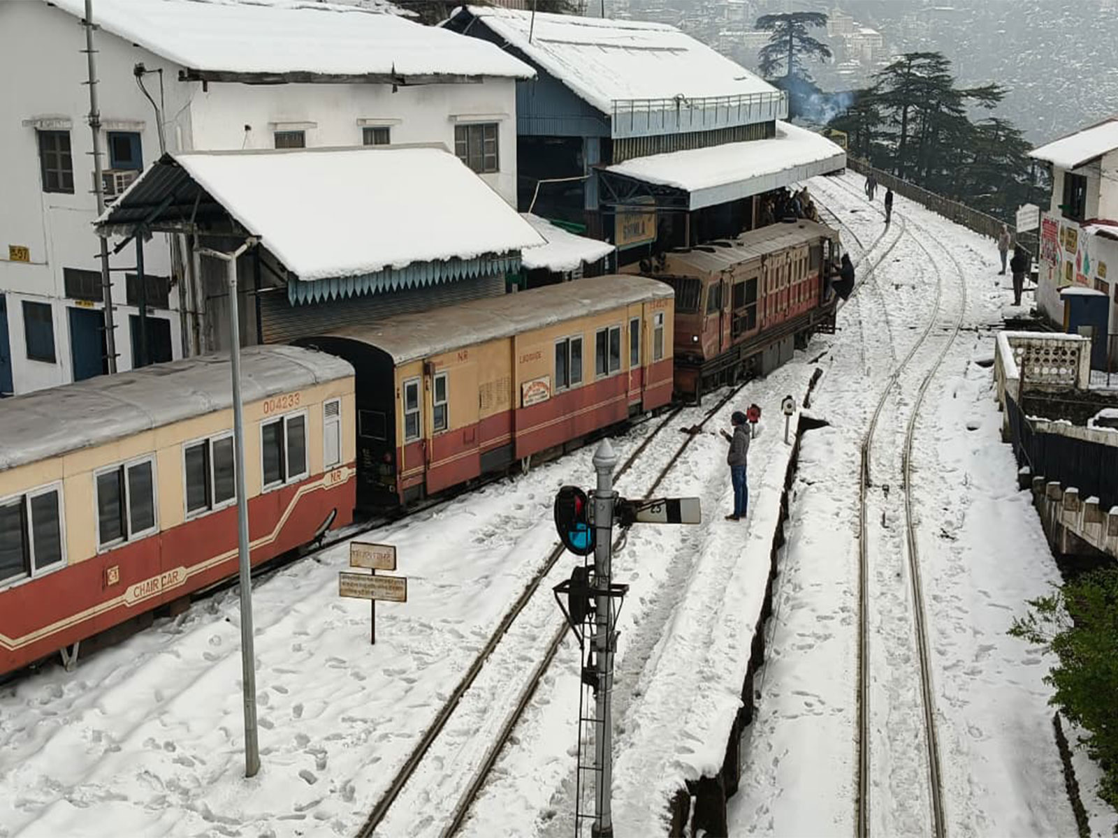
Significant rainfall was reported from Bhattiyat (Chowari) with 21.2 mm, Gohar in Mandi district with 20 mm, Sarahan with 18.5 mm, Sujanpur Tira with 18.4 mm and Dharamshala with 16.3 mm. In the higher reaches, snowfall was recorded at several locations, with Kothi in Kullu district receiving the highest snowfall of 15 cm, followed by Kalpa at around 13 cm and Sangla in Kinnaur district with about 8 to 10 cm. Jot received around 7 cm of snow, while Kufri near Shimla recorded close to 4 cm, and Manali around 2.5 cm.
Dense fog was observed in Bilaspur early in the morning, significantly reducing visibility, while moderate fog was reported in Mandi and Sundernagar. Thunderstorm and lightning accompanied rainfall in parts of Mandi and Kangra districts. Cold-day conditions prevailed in Mandi, while severe cold-day conditions were recorded in Manali, where daytime temperatures remained well below normal.
Explaining the weather situation, Senior Scientist, IMD Himachal Pradesh, Sandeep Kumar Sharma, told ANI that a western disturbance remained active over the state during the past 24 hours.
"Due to the active western disturbance, light to moderate rain and snowfall were recorded across Himachal Pradesh. The highest snowfall of 15 cm was reported from Kothi in Kullu district, followed by Kalpa and Sangla. Rain accompanied by thunderstorms was recorded in parts of Mandi and Kangra, with Gohar in Mandi district receiving the highest rainfall of about 20 mm," Sharma said.
He added that daytime temperatures dropped sharply due to snowfall and cloud cover, falling by as much as seven degrees Celsius at some places. "Cold wave-like conditions were recorded in Manali and Mandi, where maximum temperatures remained significantly below normal. Dense fog was reported in Bilaspur, while moderate fog was observed in Mandi and Sundernagar," Sharma said.
According to the IMD forecast, light rain and snowfall are likely at isolated places in mid and high hill districts on February 2 and 3, particularly in Chamba, Kinnaur, Kangra, Kullu and Lahaul-Spiti. Shimla and Mandi may witness light rain at one or two locations, while lower hill districts such as Una, Bilaspur, Hamirpur, Solan and Sirmaur are expected to remain largely dry.
"The weather is expected to remain clear across the state from February 4 to February 8. However, a weak western disturbance may affect the western Himalayan region around February 6, leading to light snowfall at the isolated reaches of Chamba and Lahaul-Spiti districts," Sharma said.
He further noted that maximum temperatures may rise by 4 to 6 degrees Celsius compared to the past 24 hours, with no major change expected till February 4. Thereafter, temperatures are likely to rise gradually across the state. Minimum temperatures are not expected to change significantly in the immediate period, but may fall by 2 to 3 degrees Celsius once the weather clears, he added.