HPU's Himalayan Centre develop early warning system for disasters; working on rare-earth-free EV technology
Sep 10, 2025
Shimla (Himachal Pradesh) [India], September 10 : Himachal Pradesh University (HPU) is making significant strides in disaster risk reduction and resilience with its newly established Himalayan Centre for Disaster Risk Reduction and Resilience.
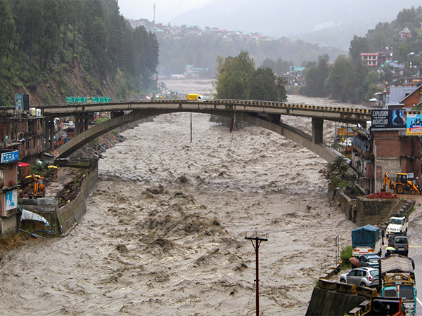
The centre aims to develop an early warning system for natural disasters in Himachal Pradesh and the Himalayan region by combining conventional local knowledge with cutting-edge artificial intelligence (AI) technology. This initiative seeks to mitigate the impact of climate change and global warming by integrating advanced scientific research, community wisdom, and policy-level outreach.
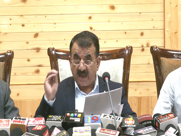
Speaking to reporters and later to ANI, HPU Vice-Chancellor Professor Mahaveer Singh said the Centre's work would go beyond academic papers and deliver practical, on-ground applications.
"The main objective of this centre is to take research from campus to community and up to the policy level. We will incorporate artificial intelligence and local community knowledge not only to develop an early warning system but also to introduce disaster mitigation and reduction courses in universities, colleges, and schools," Professor Mahaveer said.
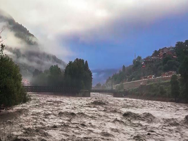
Early Warning System: The centre will leverage AI and local community insights to create an early warning system for natural disasters, focusing on areas like Shimla, Dharamshala, Mandi, and Kullu.
HPU has partnered with Norway's Norwegian Geotechnical Institute (NGI) and Italy's University of Padua to utilise Interferometric Synthetic Aperture Radar (InSAR) technology for hazard monitoring.
Professor Mahaveer added that Himachal Pradesh State Disaster Management Authority (SDMA), the National Disaster Management Institute (Government of India), and international partners have already approved collaborative agreements.
"We will organise training programmes and workshops in disaster-hit or sensitive districts, and also bring community representatives to our campus for awareness. Data accuracy is crucial, whether from NASA or satellite-based systems, and AI tools will help us pinpoint specific local vulnerabilities, such as why land is sinking or frequent landslides occur," he said.
HPU is working with the Himachal Pradesh Education Department to integrate localised disaster-related content into school curricula, building upon NCERT's existing disaster education modules.
"We are clear about college-level curriculum and even law colleges. At the school level, the challenge is deciding how much to teach in Class 6, 7, or 8. We will consult stakeholders and adapt disaster data to Himachal's context," Professor Mahaveer noted.
Alongside disaster research, HPU is pursuing nanotechnology-based materials research for green energy applications, including magnetic materials to replace rare-earth elements in electric vehicle (EV) motors, an area dominated by China.
"China holds 80% of the world's rare-earth reserves, followed by Brazil. India has very little. Rare earths are not environmentally friendly. We are developing eco-friendly magnetic materials as an alternative. One parameter for EV motors is already achieved, and we are working on the second. Our aim is to contribute to climate change mitigation, green transportation, and environmental protection," Professor Mahaveer said.
Professor Mahaveer said the centre aims to become a landmark institution for tackling climate change impacts, disaster risk mitigation, and promoting sustainable, eco-friendly technologies.
"In the next 8-9 months, we expect to reach a stage where specific data can be shared with both the government and the public for early warnings. This will save lives and reduce losses in the Himalayan region," he said.
Scientist and Assistant Professor Sansar Raj Meena, a researcher at the University of Patova, Italy, one of Europe's oldest universities, where Galileo Galilei once taught, said his team will bring advanced AI and machine learning expertise to the project.
"We work on slope stability, predictive modelling, and remote sensing data analysis for landslide risk detection. The Himalayas are vast, so we use satellite, LiDAR, UAV, and drone data for hazard mapping," Meena said.
He emphasised integrating social science with AI.
"Local communities, especially elders, are scientists in themselves; they know safe and unsafe areas. We will combine their traditional knowledge with high-performance computing and big data analysis to provide actionable recommendations at the policy level."
Meena warned about unplanned urbanisation and infrastructure development in fragile Himalayan zones.
"A river never changes its course, but if people settle in its floodplain, the river will return one day. Rapid highway construction with slope cutting can trigger future slope failures. Environmental assessments for such projects often ignore long-term hazards," he said.
He stressed that scientific reports must be written in an accessible language for government officials to act upon.
"In developing countries, reports often remain unused because officials don't understand the technical content. We need willingness from governments to work with research institutions and local communities to implement disaster preparedness tools," he said.